
Your Building Permit Is Not Proof of Your Property Line: The Step Toronto Homeowners Miss Before Building

This article covers:
- Why a building permit does not confirm your property line on the ground
- Why a land survey plan and a marked property line are not the same thing
- Why architects, designers, builders, and fences cannot confirm legal boundaries
- Why projects near a lot line need extra caution
- Why laneway suites can be especially sensitive
- When to involve an Ontario Land Surveyor before construction begins
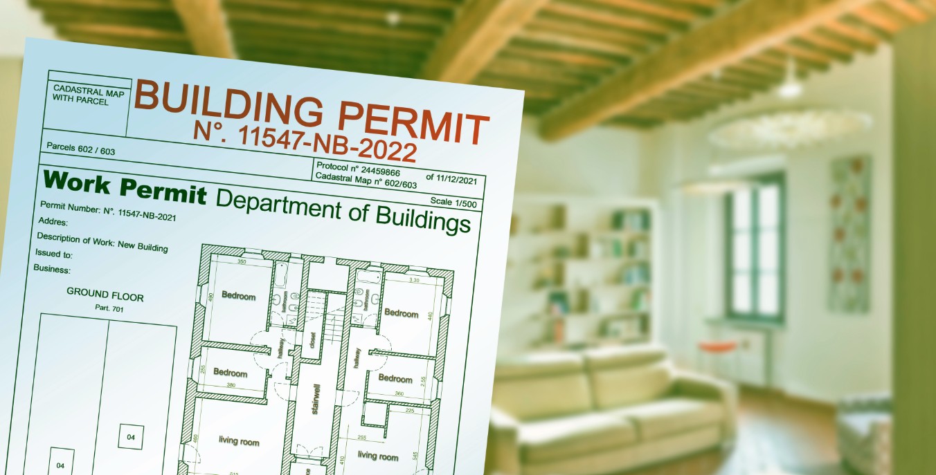
For many Toronto homeowners, a building permit feels like the final step before moving forward with a building project. Whether the project is smaller, like a shed, deck or fence , or something larger, a laneway suite, home addition, or pool, there are processes in place to help protect homeowners and neighbours from costly boundary complications.
Many permit applications require a copy of a land survey that shows lot lines, lot area, easements, existing structures, proposed structures, and setback measurements. In Toronto, for example, the small residential additions guide requires a survey showing property lines, lot area, rights-of-way or easements. It also requires the location of existing and proposed buildings, including setback dimensions to property lines and adjacent buildings.
This information is important. It helps confirm that the proposed work can be reviewed against local zoning requirements and that the project has been drawn specifically for the lot.
But once a permit has been approved, homeowners need to understand something very clearly: a permit does not confirm your property line on the ground.
This is where many homeowners make a costly mistake. They assume that because the permit was approved, they have everything they need to start building. But one important step is often overlooked: confirming where the property lines are on the physical property before construction begins.
This cannot be done by the property owner, the builder, the architect, or even the existing fence. Legal property boundaries should be located and confirmed by an Ontario Land Surveyor (OLS).
The permit package is not a boundary marker
Your permit package is built around drawings, measurements, and site information supplied to the municipality.
Your architect or designer may use your land survey plan to create drawings of the proposed work. Your builder may use those drawings to prepare for construction, but drawings do not automatically translate from paper to the ground without proper boundary confirmation.
This is especially important when construction is anywhere close to a neighbouring property or structure. If your proposed project is near a side lot line, rear lot line, laneway, fence, garage, retaining wall, or neighbouring building, the safest step is to have an Ontario Land Surveyor attend the property and mark the property line.
Architects and designers design buildings and the Builders build them. They may be very skilled at their work, but they are not Ontario Land Surveyors.
In Ontario, cadastral surveying includes surveys that establish, locate, define, or describe property lines, boundaries, or corners of parcels of land. The Association of Ontario Land Surveyors states that only licensed members of the Association can carry out cadastral, or legal boundary, surveys in Ontario.
That distinction matters. When the question is, “Where is my property line?” the answer should come from a licensed surveyor.
Misleading visible features
Many homeowners skip having a surveyor come to their property because they believe the boundary is already obvious.
They may have looked at their land survey plan. They may see where the house, garage, shed, driveway, or fence appears to sit. They may assume that existing fences, hedges, retaining walls, laneway edges, or old markers are reliable indicators of the property line.
That is often where problems begin.
A fence may have been installed for convenience, not accuracy. A hedge may have grown along a line that was never legally established. A laneway edge may look like a boundary, but that does not mean it reflects the actual property line.
In an internal review by Protect Your Boundaries that 49% of residential properties in the GTA had some sort of boundary discrepancy that could potentially lead to a dispute between neighbours.
These discrepancies often happen because people do not know exactly where their property line is. Over time, homeowners may become accustomed to using the land around their home in a certain way without ever confirming what legally belongs to them.
This can show up as a fence that was improperly placed, a shed built too close to a lot line, a garage that crosses onto neighbouring land, or a laneway access issue that was misunderstood for years.
Assumptions around property ownership can stay quiet for a long time, until someone decides to build. That is when neighbour disputes often arise, and a difficult (and costly) lesson is learned: long-standing use does not necessarily mean you are entitled to continue using the property.
Laneway suites deserve extra caution
This issue is especially important for laneway suites.
Laneway suites are often built at the rear of a Toronto lot, close to a laneway and close to neighbouring properties. Toronto’s laneway suite permit materials require a survey or site plan showing property lines, lot area, rights-of-way or easements, referenced to a current survey. They also require the location of existing and proposed buildings, including setback dimensions to property lines and adjacent buildings.
That makes sense because these projects depend heavily on precise placement. A laneway suite may be designed around tight space, required setbacks, access routes, existing garages, neighbouring structures, trees, utilities, and the shape of the lot.
The concern is not that laneway suites are a bad idea. Many Toronto homeowners see them as a useful way to create more housing, support family, or make better use of their property.
The concern is that laneway suites leave very little room for casual assumptions.
Homeowners should not rely only on the permit drawings, an old fence, or the builder’s interpretation of the site. Before construction begins, ask whether an Ontario Land Surveyor should mark the property lines or confirm the relevant boundaries on site.
Before construction starts, ask the right question
In addition to confirming that the right permits are in place, homeowners should also ask:
“Has the property line been confirmed on site by a surveyor?”
That question is especially important before building an addition, garage, deck, fence, retaining wall, garden suite, laneway suite, pool, shed, or any other structure near a lot line.
It is much easier to pause before construction than to fix a boundary problem after concrete has been poured, posts have been set, or framing has started.
If a project is close to a boundary, do not assume the builder can simply measure from the fence. Do not assume the architect’s drawings settle the issue. The property line should be confirmed properly before the work moves forward.
Start with the survey, then confirm what needs to be marked
Protect Your Boundaries helps Ontario homeowners find existing land surveys for their properties. That is often the practical first step before a renovation, addition, or new structure.
A land survey plan can help homeowners and their project team understand the property, including lot dimensions, buildings, and other important features that existed when the survey was prepared.
A survey plan in a file is not the same as having the property line marked on the ground.
Not every small project requires a new full survey. The right next step depends on the property, the project, the age and quality of the existing survey, and how close the proposed work is to the boundary.
Having an Ontario Land Surveyor come to the property and confirm the relevant lines on site is never a bad idea when building on your property. This step can make all the difference as it helps ensure the people designing and building your project are working from the right information, in the right location, before the work becomes expensive to correct.
A permit matters. Good drawings matter. A skilled builder matters, but when the question is, “Where is my property line?” the answer should come from a surveyor.
Looking for Your Property Documents?
Visit ProtectYourBoundaries.ca to see what property documents and products are available for your address, including existing survey plans and BoundaryPLUS Property Reports.
Our BoundaryPLUS reports can help homeowners, buyers, and sellers better understand important property information, including registered easements, rights-of-way, and other title-related details.
Not sure what you are looking for, or have questions about a property? Contact our team for more information.
Like our content? Click here to have Google show you more Protect Your Boundaries results
See Also:







Protect Your Boundaries Inc. is a licensed member of the Association of Ontario Land Surveyors, and is entitled to provide cadastral surveying services to the public of the Province of Ontario in accordance with the provisions of the Surveyors Act R.S.O. 1990, Chapter S29.