
Roncesvalles: The Soldier, the Survey and the Story Behind the Name

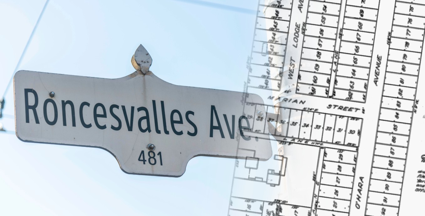
There are certain street names in Toronto that you stop noticing after a while, and Roncesvalles is probably one of them.
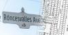
Commonly referred to as “Roncy” around the neighbourhood, today the name means a neighbourhood, a streetcar ride, shops and restaurants, and one of Toronto’s most recognizable west-end streets.
It was a recent conversation with a friend about that trendy “Roncy” nickname that got me wondering how Roncesvalles ended up as such a prominent name in Toronto in the first place. A quick archival search sent me down a trail involving a soldier named Walter O’Hara, an old country estate called West Lodge, and two remarkable survey plans that still preserve his imprint on the city.
Who Was Walter O’Hara?
Walter O’Hara was born in Ireland in 1787. He studied at Trinity College in Dublin, before entering military service in 1808.
O’Hara served during the Napoleonic Wars, including campaigns in the Iberian Peninsula where he earned the Peninsula Medal with eight clasps, foreign decorations and a knighthood in Portugal’s Order of the Tower and Sword.
In 1822, O’Hara married Marian Murray. Four years later, the family left Ireland for Upper Canada.
By 1831, O’Hara had settled on Park Lot 31, west of the growing town of York and this is where his imprint on Toronto begins.
Finding West Lodge
O’Hara established a country estate on Park Lot 31 called West Lodge, named for his family's ancestral estate back in Ireland. The location would be in today’s Queen Street West and Lansdowne Avenue.
The house is long gone, but one of the old survey plans in our collection takes us remarkably close to it.
Registered Plan 387, dated 1875, is titled:
Plan Shewing Subdivision of the South Portion of Park Lot No. 31 in the 1st Concession from the Bay, Township of York, Known as West Lodge.
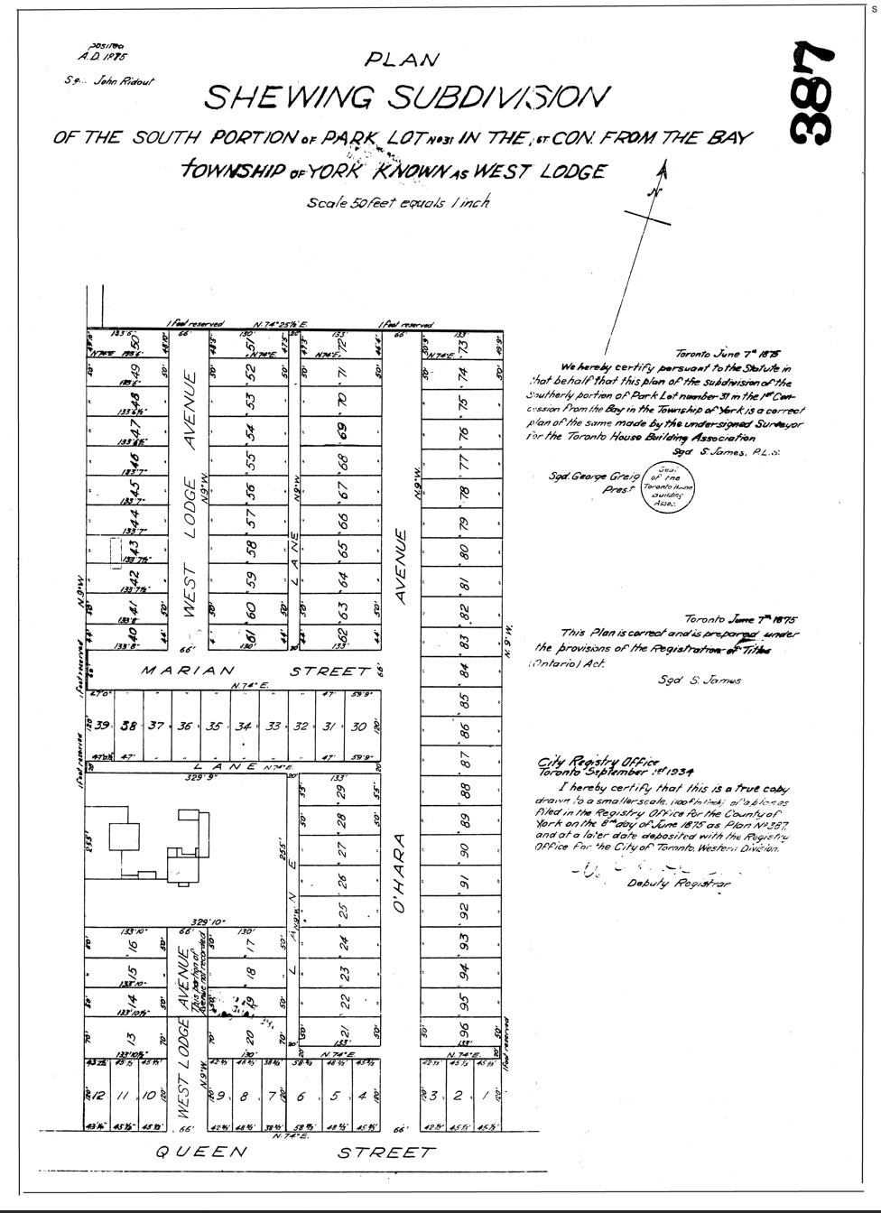
One this survey, we see West Lodge, written directly onto the document.
The timing of this survey is significant as O’Hara had died the previous year, and the plan captures his former estate as the land was being divided for development.
The new streets also preserve familiar names: O’Hara Avenue, West Lodge Avenue and Marian Street.
Today we know a street in this area as Marion Street, but the 1875 survey clearly reads “Marian Street”, the same spelling as O’Hara’s wife, Marian Murray.
Most of the property had been divided into building lots, but one large parcel remained intact. Several existing buildings were still shown within it.
This raised the question: Were these the surviving buildings of the West Lodge estate?
A later map provided another piece of the puzzle.
After O’Hara’s death, West Lodge passed to William Innes Mackenzie, who was associated with the Toronto House Building Association. In 1876, Mackenzie sold the property to the Sisters of the Good Shepherd, who operated a Magdalene asylum and convent there – an interesting connection between two very different chapters in the history of the same land.
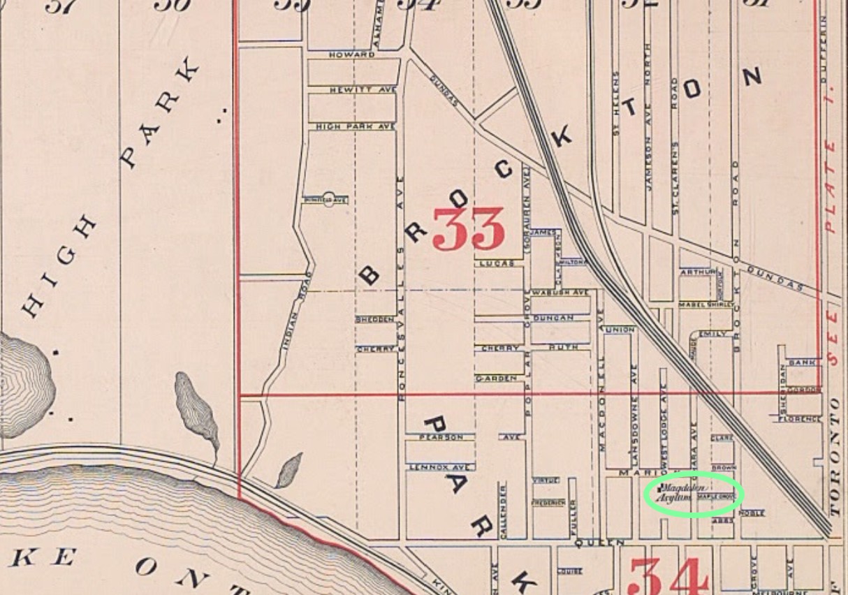
On the 1884 Goad Fire Insurance Map, the same location is “Magdalen Asylum” (circled in green on the map). This provides another piece of evidence connecting the buildings shown on the earlier survey with the former West Lodge property.
The map doesn’t tell us which individual building shown on the 1875 survey was O’Hara’s house, but together the records help us follow the former West Lodge estate into its next chapter.
So Why Is It Called Roncesvalles?
The name actually comes from a place in the Spanish Pyrenees, near the natural border between France and Spain. Roncesvalles recalls one of the places associated with Walter O’Hara’s military service during the Napoleonic Wars.
Nearby Sorauren Avenue has a similar origin, recalling another place associated with the fighting in which O’Hara served.
Which creates a pretty remarkable historical connection. The wars of Napoleon Bonaparte, fought an ocean away, left their mark on the street map of Toronto. O’Hara carried the names of places he knew from the war with him to Upper Canada, and decades later put them on the landscape here.
O’Hara purchased Park Lots 33 and 34 in 1840. City research records that he subdivided those lands in 1856, creating Roncesvalles and Sorauren avenues, before the property was further subdivided in 1868.
And we have a survey from that second stage.
Registered Plan 287, filed in 1868, covers Lots 33 and 34. Beneath its title are four particularly useful words:
“The Property of Colonel O’Hara.”
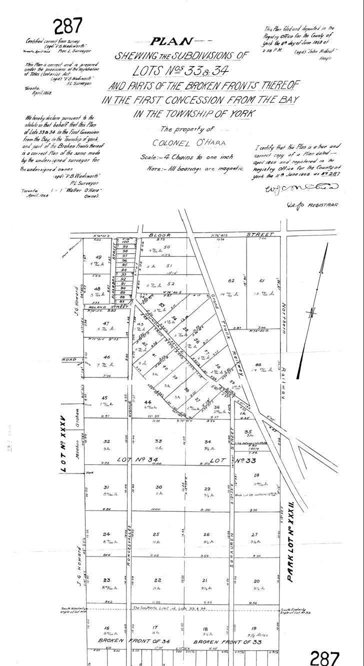
The plan shows Roncesvalles and Sorauren running through O’Hara’s lands, along with large parcels that bear little resemblance to the dense urban lots there today. The Grand Trunk Railway crosses the northern portion of the subdivision, and John G. Howards property to the west.
The streets are there, and the names are there, but the neighbourhood we recognize today has yet to emerge.
A Family Written into the Map
Once you know O’Hara’s story, some of the other street names around Roncesvalles begin to make more sense.
Library and Archives Canada connect Marion, Constance and Geoffrey with members of the O’Hara family, while historical research also identifies earlier streets named Ruth and Walter, subsequently renamed Fern and Grenadier.
Then there are the names we can see ourselves on Plan 387: O’Hara Avenue, West Lodge Avenue and Marian Street.
Taken together, the maps preserve pieces of O’Hara’s life: his family, his home and memories associated with his military service.
That’s one of the things I find so interesting about historic plans.
At first glance, they’re technical documents filled with bearings, distances and lot numbers but behind all those numbers and measurements, there are sometimes biographies waiting to be uncovered.
Following the Paper Trail
Put these old plans together and pieces of Walter O’Hara’s Toronto begin to reappear.
Plan 287 shows the lands where Roncesvalles and Sorauren were taking shape. Plan 387 identifies his former estate by name: West Lodge.
Goad’s 1884 map shows the same property after it had passed into institutional use as the Magdalen Asylum.
Over time, the country estate disappeared and the large acreage parcels became city blocks. Yet while the landscape changed, many of the names associated with O’Hara survived, leaving a lasting imprint on the neighbourhood we now call “Roncy.”
Nearly two centuries after Walter O’Hara arrived in Upper Canada, the names he associated with his family, his home and his military past are still scattered across this part of Toronto. Roncesvalles may be the most recognizable of them, but the old surveys show just how much of his story remains written into the neighbourhood.
References
Library and Archives Canada. “Diary of Walter O’Hara, 1826–1842.” Walter O’Hara Fonds. Library and Archives Canada
City of Toronto. Heritage Research and Evaluation Report: 41 Wabash Avenue. City of Toronto
Architectural Conservancy Ontario. “Walter O’Hara’s West Lodge Estate.” ACO Toronto. ACO Toronto
Mayers, Adam. “Soldier’s Story Forever Etched in City Streets.” Toronto Star, 21 Aug. 2007. Toronto Star
Registered Plan 287. 1868. Protect Your Boundaries / Krcmar Surveyors Ltd. archive.
Registered Plan 387. 1875. Protect Your Boundaries / Krcmar Surveyors Ltd. archive.
Goad, Charles E. Atlas of the City of Toronto and Vicinity. 1884. Toronto Public Library. Online presentation compiled by Nathan Ng. Goad’s 1884 Toronto Fire Insurance Atlas
You May Also Like:
If you enjoyed uncovering the history hidden behind Roncesvalles, here are a few more stories where old surveys reveal unexpected layers of Toronto’s past:
Buried Beneath Bloor: Yorkville’s Forgotten Past
Another surprising connection to Toronto’s Magdalen asylums, discovered through the historic record beneath modern Yorkville.
A Surveyor’s Vision: John G. Howard and High Park
Just west of Roncesvalles, explore how surveyor and landowner John G. Howard left his own lasting imprint on Toronto’s landscape.
Locked Up in Liberty: When Surveys Reveal Hard Truths
Historic surveys uncover the institutional past beneath Liberty Village, including the Mercer Reformatory and Toronto Central Prison.







Protect Your Boundaries Inc. is a licensed member of the Association of Ontario Land Surveyors, and is entitled to provide cadastral surveying services to the public of the Province of Ontario in accordance with the provisions of the Surveyors Act R.S.O. 1990, Chapter S29.