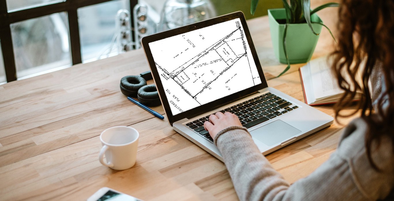
The Surveyor’s Real Property Report (SRPR)

Protect Your Boundaries has a variety of different surveys available for sale. When you are browsing our site, you might come across something called a Surveyors Real Property Report, or SRPR and wonder if this is the right product for you.
What is an SRPR?
An SRPR is a highly informative document and has become the most common type of survey used to show the precise location of:
- Property boundaries.
- Buildings.
- Fences, and
- Other structures situated on the property.
The SRPR is also the most common type of plan used for real estate transactions and is also commonly used for permit applications, when a homeowner has decided to make any changes on their property such as:
building a shed, a gazebo, a deck a fence; a home addition, or any other structure on a property.
Who Requires an SRPR?
SRPR’s are a crucial tool for anyone looking to make changes to their landscape or build on their property. Without an SRPR homeowners run the risk of building illegally and facing expensive costs to correct the problem.
Why Is an SRPR Important?
Since an SRPR shows buildings and structures, as well as the distances to the boundary lines in relation to them, also known as ties, the plan is detailed enough to allow someone to see how a building project will impact the land and any surrounding properties.
These specific details also help homeowners looking to make changes to their property make sure they are staying within their boundary lines and not encroaching on the neighbouring property; unlike a Registered or Subdivision plan that only shows property dimensions and therefor shows no reference points for the average homeowner to approximate the boundary lines.
How is an SRPR Prepared?
Only a licensed Ontario Land Surveyor (OLS) can create a survey plan for a property located within the Province of Ontario. An OLS prepares a survey plan in accordance with the regulations set out in the Generally Accepted Surveying Principles.
The surveyor finds the property boundaries using evidence of prior surveys, older plans, and the legal description of land, in combination with on-site evidence to formulate a professional opinion of the location of the boundaries.
Creating a land survey is a rigorous procedure involving research, analysis, and computation to produce a computer-drawn plan. Plans are drawn in accordance with professional standards, reviewed and approved by an OLS, and subject to peer review through the industry's governing body.
An SRPR is usually prepared for a single client, or property, is dated and signed by a licensed surveyor. Your SRPR will also include title information.
SRPR’s are not filed with the Land Registry Office. Instead, they remain with the survey firm, and they retain the copyright to the plan.
Where can I find an SRPR of my property?
Protect Your Boundaries has made SRPR's available to the public, covering almost one million residential properties in the GTA. All of our surveys are available for download; once purchased they are delivered straight to your email with a link for your digital copy.
Type in your address to see if we have an SRPR available for your property:
If you still have questions, or are not sure if an SRPR is the right plan for you, feel free to contact our office or visit our website at www.ProtectYourBoundaries.ca for more information and reading materials.


Protect Your Boundaries Inc. is a licensed member of the Association of Ontario Land Surveyors, and is entitled to provide cadastral surveying services to the public of the Province of Ontario in accordance with the provisions of the Surveyors Act R.S.O. 1990, Chapter S29.