The Tools Behind Your Land Survey: What Ontario Homeowners Rarely See

When Ontario homeowners think about a land survey, they often picture someone with a tripod in their yard, or maybe a long measuring tape. That image is not wrong, but today’s residential land survey involves highly advanced equipment, digital data, and professional expertise.
Understanding the tools used helps you understand why a land survey is such a critical document for protecting your property investment.
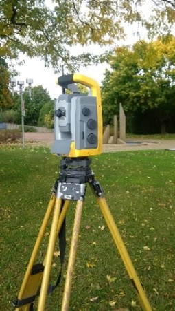
Total Station
|
A total station is one of the primary tools used by an Ontario Land Surveyor. It combines electronic distance measurement and angle measurement in one instrument. Mounted on a tripod, it allows the surveyor to measure: • Property boundary angles The total station captures precise measurements and records them digitally. Even small errors in angle or distance could shift a boundary by several inches or more, which is why this equipment must be operated and calibrated professionally. |
 |
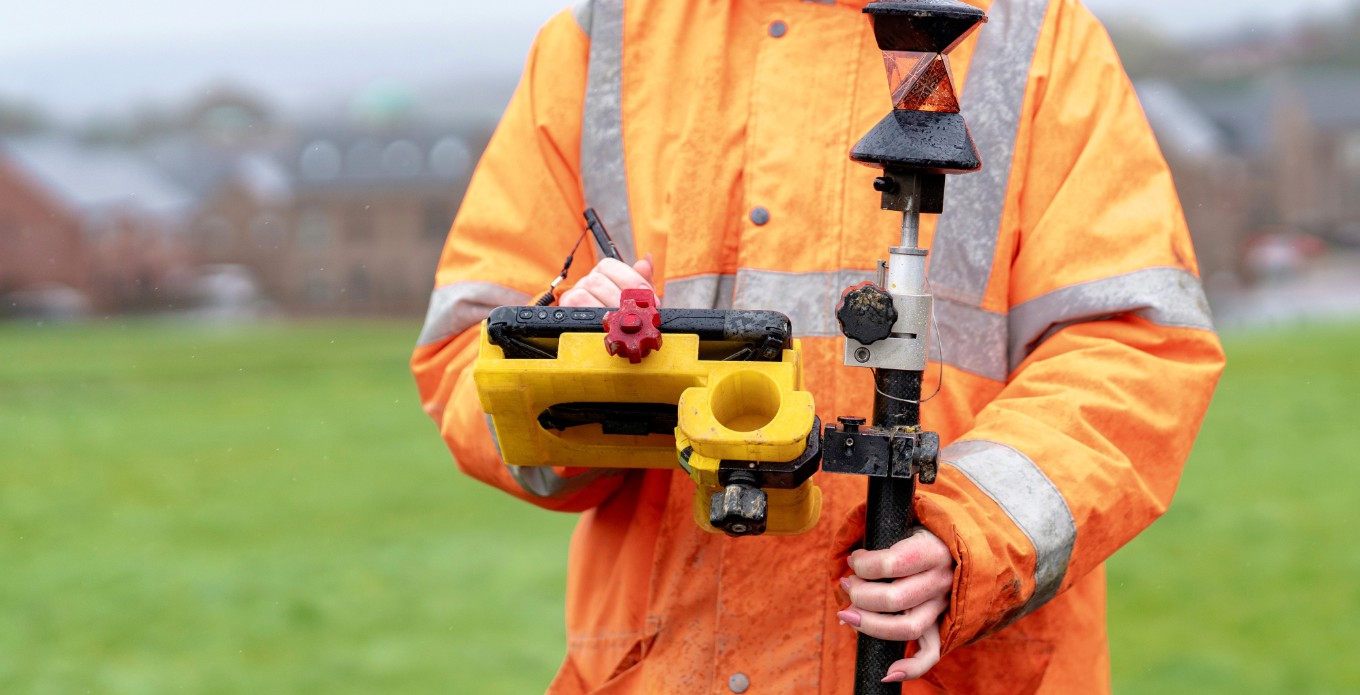
Measuring Rods, Prisms, and Reflectors
Measuring rods and prisms are used alongside a total station to capture precise distances and elevations. The prism reflects the signal from the instrument, allowing the surveyor to record exact locations of building corners, fences, decks, garages, and other structures on the property. This level of precision ensures that what is shown on the land survey accurately reflects what exists on the ground.
These tools help:
- Capture elevation changes
- Record building corners
- Map fences, sheds, driveways, and additions
Accuracy here matters if you are planning to build or confirm that something is inside your boundary.
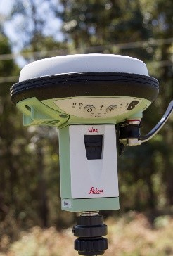
GNSS and GPS Survey Equipment
|
Modern land surveys often use the Global Navigation Satellite System (GNSS), which is a highly advanced form of GPS technology. Survey-grade GPS equipment is far more accurate than consumer GPS devices. This technology: • Connects to satellite networks For larger residential lots, rural properties, or subdivisions, GNSS improves efficiency and precision. |
 |
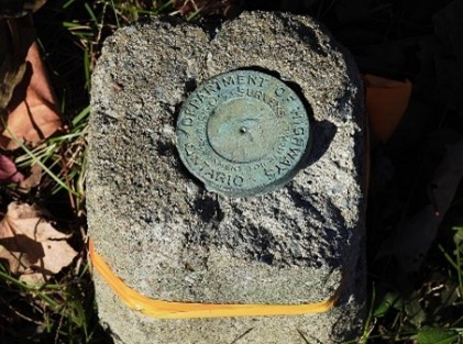
Survey Markers and Monuments
|
Many Ontario properties have iron bars or survey monuments marking their legal corner points. These metal rods are usually set flush into the ground and define where one property ends and another begins. Over time, they can become buried, disturbed, or removed. During a land survey, the surveyor will locate and verify these markers or re-establish the boundary if they are missing.
These markers:
• Legally represent property boundaries
• Are referenced in registered survey plans
• Must not be moved or altered
If bars are missing, only a licensed Ontario Land Surveyor can re-establish them based on legal records and measurements.
|
 |
Drones and Aerial Survey Technology
In some cases, surveyors use drones to collect aerial imagery and topographic data. While not required for every residential survey, drones can be useful for:
- Large properties
- Complex terrain
- Detailed topographic mapping
The data collected is later processed and tied to ground measurements for accuracy.
Office Software and Legal Research Tools
Field work is only one part of a land survey. In addition to taking precise measurements on your property, Ontario Land Surveyors review historical registered survey plans, parcel records, and title documents to understand how the boundaries were originally established. They then use advanced drafting and CAD software to prepare the final survey plan. What you receive is not just a set of measurements, but a professional interpretation of your legal property boundaries based on both field evidence and documented records.
Why This Matters for Ontario Homeowners
A land survey is not just someone measuring your yard. It is a combination of legal research, precision instruments, and professional interpretation.
If you are planning to make changes to your property, having a copy of your land survey plan before you begin is not an obstacle; it is an essential step.
Without an accurate land survey, you are relying on assumptions. In Ontario, assumptions about boundaries can lead to disputes, stop work orders, or costly corrections.
Visit the Protect Your Boundaries website to see if an existing copy of your survey plan is available, or send us an email for assistance in locating your plan.
Image References
1. Wikimedia Commons contributors. Total Robotic Station. Wikimedia Commons. Available here: Total Station
2. Wikimedia Commons contributors. An old Department of Highways (of Ontario) survey marker at the entrance to the Butler House in Orleans (Ottawa), Ontario (24473264328). Wikimedia Commons. Available here: Survey Monument
3. PxHere contributors. Record, Light, Green, Instrument, Measure, Lighting, Science, Survey, Position, GPS Receiver. PxHere. Available at:https://pxhere.com/en/photo/673503


Protect Your Boundaries Inc. is a licensed member of the Association of Ontario Land Surveyors, and is entitled to provide cadastral surveying services to the public of the Province of Ontario in accordance with the provisions of the Surveyors Act R.S.O. 1990, Chapter S29.