
Buried Beneath Bloor: Yorkville’s Forgotten Past

|
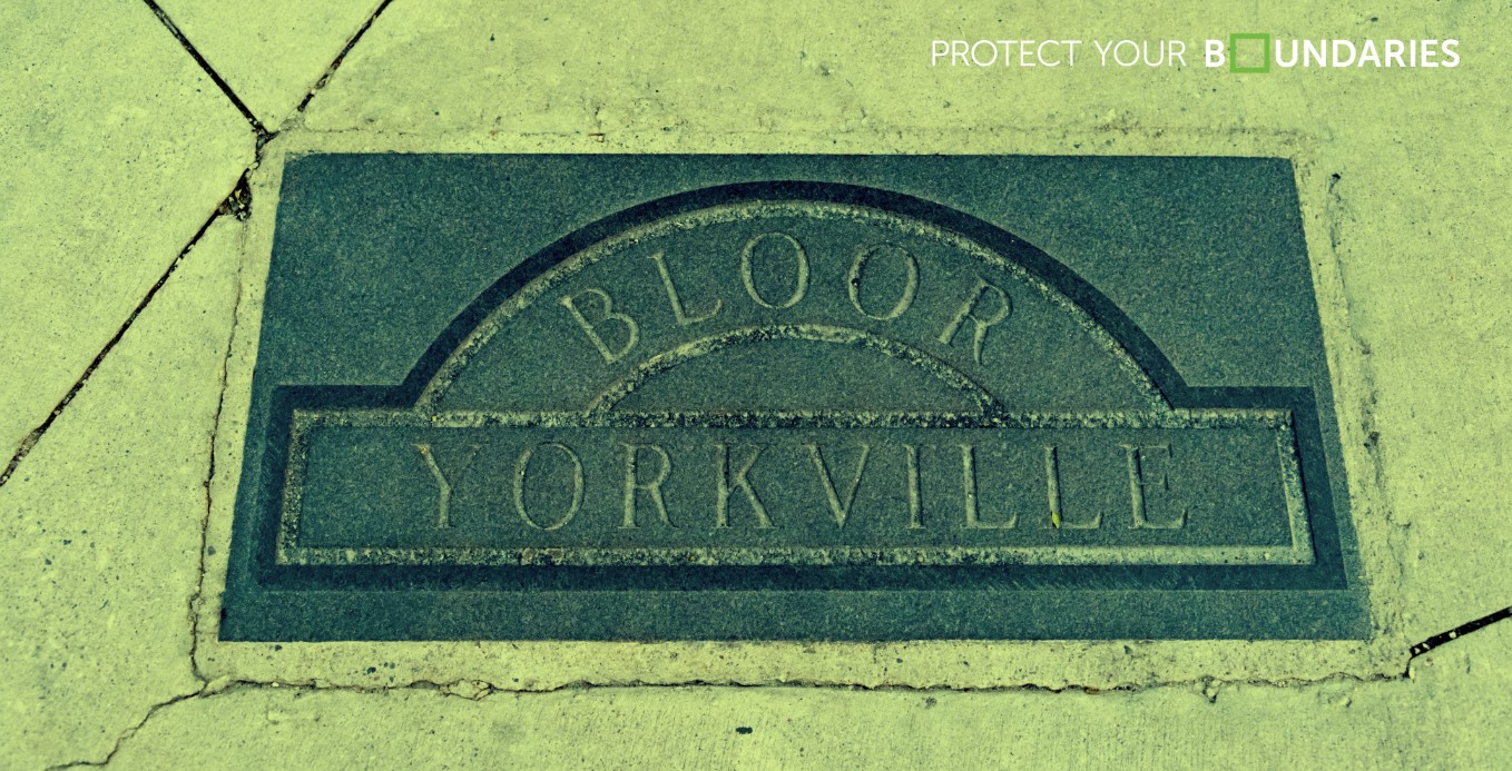
Today, Yorkville is known for luxury retail stores, upscale condominiums, restaurants, and some of Toronto’s most recognizable streets. But while reviewing some early survey plans of Yorkville Village, I found one that stood out for its strikingly different landscape from the current state of Yorkville. Many of the streets shown on the survey have since been renamed, shifted, or absorbed into modern development. Large estate lots that once belonged to private landowners have disappeared beneath dense urban construction, and areas that were once residential or institutional lands are now occupied by commercial buildings and high-end retail stores. What makes historic survey plans so fascinating is their ability to preserve these forgotten layers of the city. Long before Yorkville became one of Toronto’s wealthiest neighbourhoods, it was a growing village made up of burial grounds, charitable institutions, industrial lands, and sprawling residential properties. Two locations in particular stood out on this survey: the Magdalen Asylum and Potter’s Field. The Magdalen AsylumOne institution that immediately stands out on the survey is the Magdalen Asylum. A quick search reveals that the asylum was established as a refuge for “fallen women,” a term commonly used during the Victorian era to describe women facing poverty, homelessness, abuse, prostitution, or social ostracization. The institution was named after the Biblical figure Mary Magdalene, who was historically associated with repentance and redemption. Its appearance on the survey immediately brought to mind a previous article on Liberty Village and the Mercer Reformatory, another institution connected to the social treatment of women during the 19th century. While places like the Mercer Reformatory were designed for the confinement and reform of women labeled “incorrigible,” the Magdalen Asylum was more commonly described as a refuge intended to provide shelter, care, and rehabilitation for vulnerable women. Like many institutions of the era, the realities were likely far more complex. By the 1880s, the organization recognized a growing need for facilities dedicated to elderly women and expanded its services to accommodate them. In 1891, a separate building was constructed to house elderly female residents, and elderly men were later admitted as well. Over time, the institution gradually shifted away from its original purpose, and officially opened as Belmont House, an old-age home for both men and women, in 1908. Today, the site is home to Belmont House, a well-known retirement residence located near Davenport Road and Belmont Street, shown as “Beverly Street” on this historic survey plan. Potter’s FieldThe next landmark of significance shown on this survey plan is Potter’s Field, located between Sydenham Street (now Cumberland Street) and Bloor Street, which is not clearly labelled on the survey itself. Potter’s Field was a six-acre farm lot used as a burial ground for the poor, unclaimed, and unidentified deceased. While the concept may seem unsettling today, burial grounds like this were essential during the 19th century and were not considered unusual. Before large municipal cemeteries became common, churchyards and smaller burial grounds frequently became overcrowded. Potter’s Field, then situated on the outskirts of Toronto’s downtown core, provided much-needed burial space for those who could not afford private cemetery plots. |
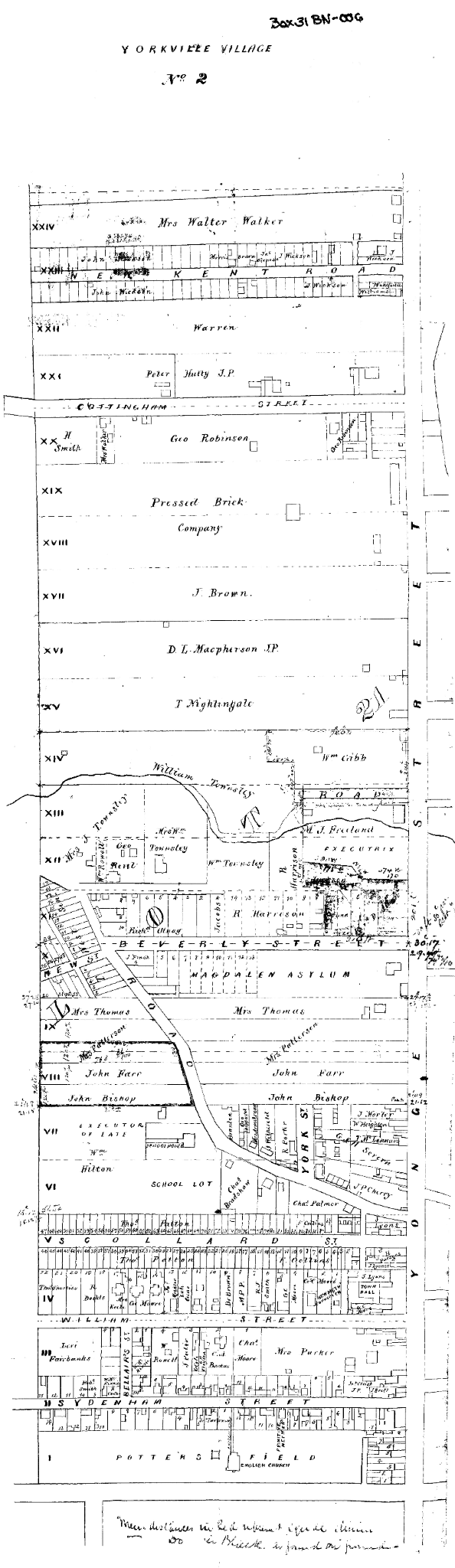 |
As the city expanded, the land became more valuable, and burial grounds like Potters field became obstacles to development. Families with relatives buried there were given the option to relocate their loved ones, though many were not removed and the land was eventually built over.
Today this land that runs along Bloor from Yonge Street to Belair Street has been transformed into one of Toronto’s most recognizable luxury retail districts, occupied by ALO, Holt Renfrew, Harry Rosen and a dozen of other popular high-end retailers, marking a striking contrast to the 1850 Potters Field burial ground.
Beneath the busy sidewalks and storefronts is the Bloor Subway line that runs directly through the area, historic surveys of the area offer people the understanding that that Yorkville’s history isn’t just around them, it is literally buried directly beneath their feet.
Reading the History Beneath the City
Historic survey plans provide more than property boundaries and lot dimensions. They capture moments in time and preserve landscapes that no longer exist.
Without these plans, many of these stories would be difficult to trace or completely forgotten.
Today, Yorkville represents luxury and modern development, but historic surveys remind us that beneath the storefronts, transit lines, and condominiums is a much older landscape — one shaped by the people, institutions, and communities that once occupied the land long before the neighbourhood became what we recognize today.
References:
1. Belmont House. “Our History.” Belmont House, www.belmonthouse.com/our-history/.
2. “Magdalen Asylum.” Toronto History, www.torontohistory.net/magdalen-asylum/.
3. “Potter’s Field Cemetery.” Toronto History, www.torontohistory.net/potters-field-cemetery/.
4. “Toronto’s Potter’s Field and the Development of the City.” Past Imperfect, University of Alberta, journals.library.ualberta.ca/pi/index.php/pi/article/view/29426/21408.
5. Survey Images sourced from Protect Your Boundaries Archive. Protect Your Boundaries, www.protectyourboundaries.ca.









Protect Your Boundaries Inc. is a licensed member of the Association of Ontario Land Surveyors, and is entitled to provide cadastral surveying services to the public of the Province of Ontario in accordance with the provisions of the Surveyors Act R.S.O. 1990, Chapter S29.