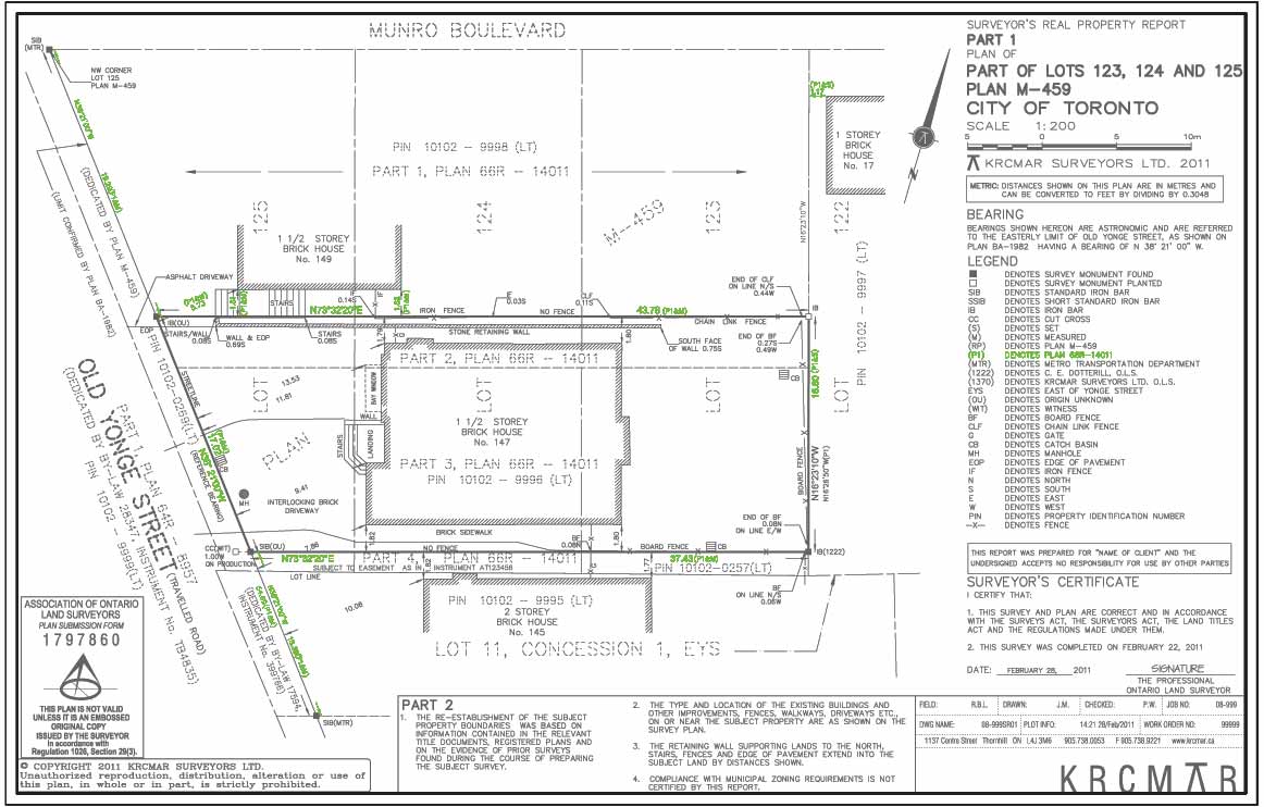
(P1) - Reference Plan
Description
Previous survey plans provide documentary evidence for a surveyor's consideration in giving their legal boundary opinion. All available survey plans, underlying and adjacent, are taken into consideration including deposited reference plans, Boundaries Act plans, subdivision plans and private plans of survey/field notes. Note that the source of all derived distances or directions must be identified and credited on the survey plan, when used to re-establish or verify property boundary corners, angles, curves or bends.
Purpose
Identifies and credits plans from which a measurement or direction has been taken.
Why is this important?
Identifies existing plans of record from which distances and/or directions are referenced on the face of the plan.
Protect Your Boundaries Inc. is a licensed member of the Association of Ontario Land Surveyors, and is entitled to provide cadastral surveying services to the public of the Province of Ontario in accordance with the provisions of the Surveyors Act R.S.O. 1990, Chapter S29.