(RP) - The Subdivision Plan
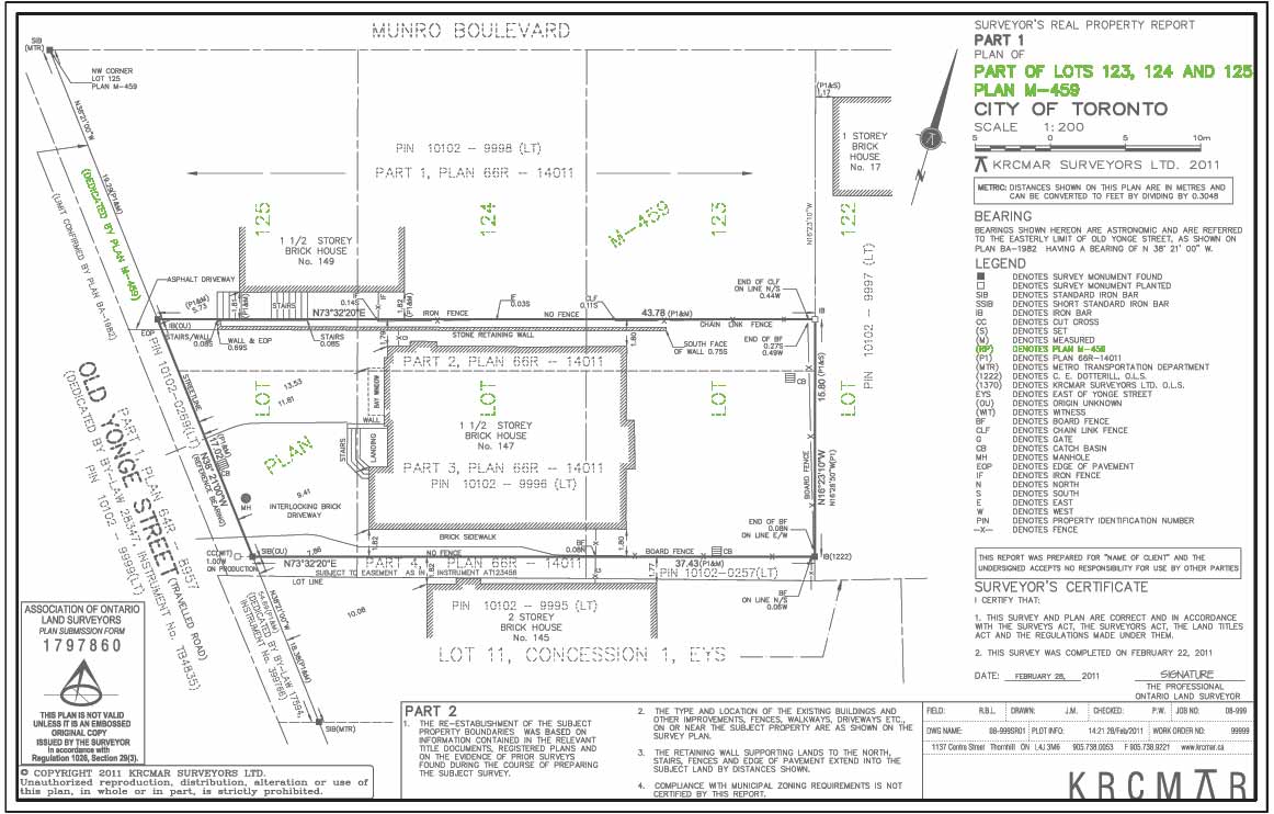
Description
Identifies the public subdivision or registered plan that was filed in the land registry office and forms the underlying lot fabric on which this survey sits. Registered or subdivision plans, on registration at the land registry office, create a new geographic identity for the land. The land is no longer referred to as being part of the township lot and must be described by reference to the numbered or named subdivision plan. They are one of many plan types used by surveyors to re-establish boundaries, and are particularly helpful in that they provide the official individual lot dimensions.
Purpose
Identifies and credits the public registered or subdivision plan from which measurements and/or directions have been taken.
Why is this important?
Identifies information shown on the underlying plan of subdivision. This includes lot fabric as well as bearings and distances. It is the plan that subdivided the original farm lot.
The Subdivision Plan Video
Protect Your Boundaries Inc. is a licensed member of the Association of Ontario Land Surveyors, and is entitled to provide cadastral surveying services to the public of the Province of Ontario in accordance with the provisions of the Surveyors Act R.S.O. 1990, Chapter S29.