Fences
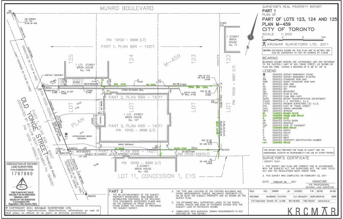
Description
There is important legal significance attached to the existence of fencing and other property enclosures (walls, hedges etc.). In some instances fences can be accepted as survey evidence of the original location of property lines. The presumption is that owners built fences and other enclosures when the location of the property limits or corner monuments (e.g. cedar stakes) was known. In other cases fences were erected as an attempt to mark a boundary without benefit of survey and to restrict others from trespassing. This may have been done as an agreement between neighbours or unilaterally. Money would not have been expended by landowners without a genuine belief that the improved and enclosed land was theirs. There are other circumstances where fences were erected without any regard for the boundary and were erected as an adversarial act to enclose land of their neighbour or implement physical occupation. Often the people who took these actions are long gone and unavailable to verify the purpose of the fence. In any case the surveyor is obligated to show the location of fences and other enclosures in relation to his/her opinion of the location of the boundary. Fences can be strong evidence of occupation and could lead to a claim of adverse possession if certain conditions are met. Aside from land registered under the Land Titles Act, adverse possession (also known as ""squatter's rights"") claims may still be made. It was certainly of historic concern to land owners. However, recent real estate legislation changes have made claims of adverse possession more difficult to prove and subject to a 10 year statutory limitation period prior to the date of conversion form Registry to the Land Titles system.
Purpose
Describes the type of fence, if any, enclosing the property and the visual representation on the survey plan.
Why is this important?
The location and type of fence (or its absence), as of the date of the survey, signifies who has been using land and for how long. Think of survey plans as historic documents providing a snapshot of the fence and boundary relationship as of the date on the survey plan.
Protect Your Boundaries Inc. is a licensed member of the Association of Ontario Land Surveyors, and is entitled to provide cadastral surveying services to the public of the Province of Ontario in accordance with the provisions of the Surveyors Act R.S.O. 1990, Chapter S29.