The Roads
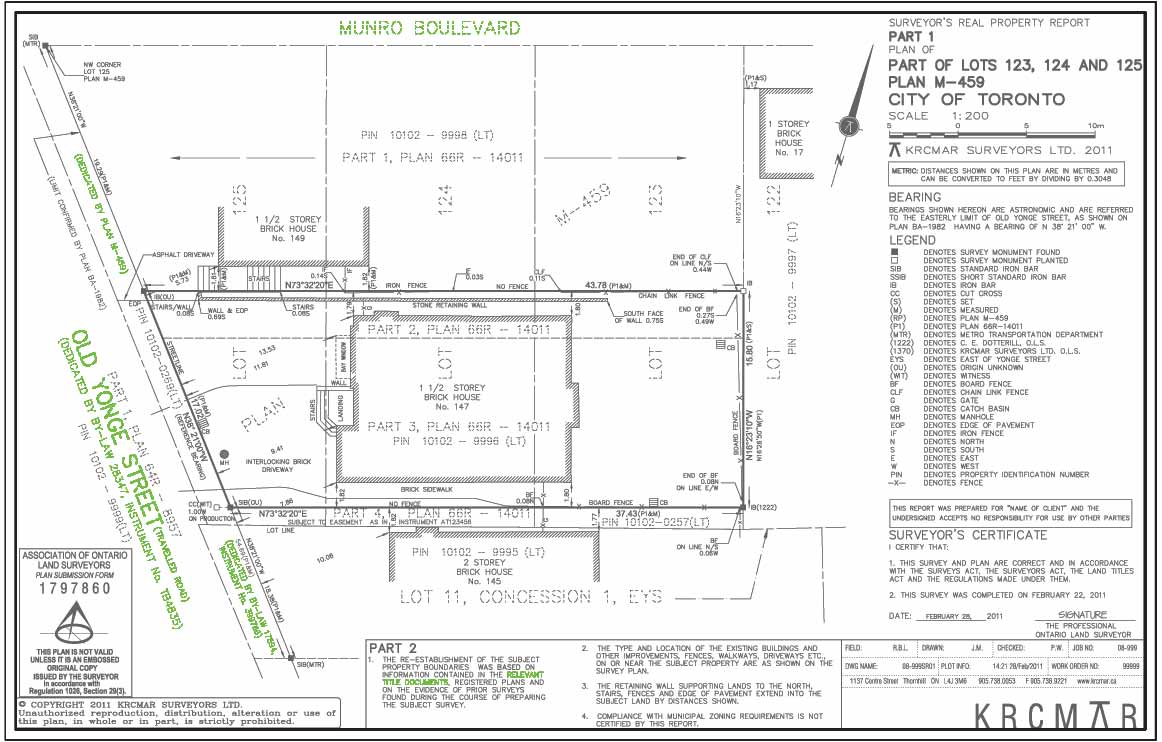
Description
A survey shows the property in relation to public roads. Often, road names have been changed over time. A survey plan will show both current and former road names, and the legal origin of how the road came into public use and details of previous land expropriations and public road widenings. Survey boundary evidence may also be shown further down the street, and street intersection information is included for reference.
Purpose
To locate the property in relation to the surrounding municipal streets and to confirm that the property is fronting onto a public road.
Why is this important?
Relates the plan to the municipal street name fabric that you recognize.
Protect Your Boundaries Inc. is a licensed member of the Association of Ontario Land Surveyors, and is entitled to provide cadastral surveying services to the public of the Province of Ontario in accordance with the provisions of the Surveyors Act R.S.O. 1990, Chapter S29.